The blessing of rain dampens Holy Week in drought-stricken Spain


QUESADA, Spain (AP) — Some much need rain was not going to ruin Holy Week for Alfonso del Río Martínez and his fellow Christians in the southern Spanish village of Quesada.

So when there was a break in the wet weather, they completed their annual act of spiritual devotion by parading a float bearing Christ and the Virgen through the streets of their town of some 5,000 people.

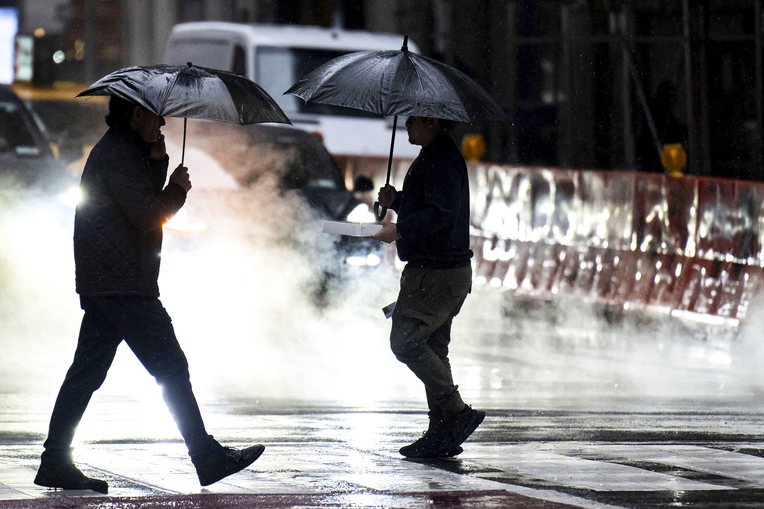
The rains during Holy Week were a blessing for large swaths of Spain suffering from chronic drought, even if they put a serious damper on the country’s intensely celebrated Easter. Many cities, towns and villages had to cancel Holy Week processions due to the persistent storms that pelted the Iberian Peninsula.

When the drops did start to fall near the end of Saturday’s procession in Quesada, a plastic tarp was quickly produced and draped over the crucifix that was being borne on the shoulders of local men and women.

Del Río called the shower that fell over the procession a “miracle” for the area, where olive orchards essential to the local economy have been hit hard by the lack of water.

“We have been through two years of drought that have left the two reservoirs that we have here completely dry, and we were asking for water desperately,” said Del Río, president of the association for Quesada’s parishes participating in the processions.

“At the same time, we had been waiting for it to rain all year and it just had to rain over these seven days. (But) we have all accepted it without any complaint since the rain is more than welcome.”

The scene of dozens of people bearing large wooden floats on their backs to parade elaborately decorated statues of Christ and/or the Virgen has been reproduced each Holy Week since Medieval times across Spain. The festivities attract the faithful but also many people who just want to experience the occasion.

While the processions take place over just a handful of days, preparations are a year-round affair. So missing out completely on the event can be a real disappointment for those involved.

Seville, which draws in thousands of spectators each Holy Week for the spectacle, had to cancel processions this past week due to the persistent rain for the first time in over a decade.

In Logroño, in northern Spain, porters were left distraught and some in tears when told that their procession had been called off.

While a letdown for many, the rain was undoubtedly a huge relief for many more — and farmers especially, who have seen serious restrictions placed on irrigation.

The faithful have tried to combat the drought by appealing to divine intervention, even in a deeply traditional Roman Catholic country that is quickly growing more secular. In Catalonia, the northeastern region around Barcelona, some village parishes have revived the faded practice of holding a special Mass and procession in hopes for rain.

Spain’s total water reserves were at 57% capacity before the Holy Week rains, but with drastic differences between the wet northern Atlantic coast and the parched northeast Mediterranean and south. While reservoirs of Spain’s northern Atlantic area were at or near 90% capacity, Catalonia was down to just 15% and parts of the south were just above 20%.

The storm front that unleashed downpours over Spain during Holy Week was behind the winds and big waves that lashed the coastline Friday, when four people died after falling into the sea.

___

Associated Press writer Joseph Wilson in Barcelona contributed to this report.


Source link

Torrential rain may snarl Easter travel in California


Torrential rain may snarl Easter travel in California – CBS News

Watch CBS News


Travel delays could be in store for those flying out West, with 20 million people in California in the path of torrential rains and flash flooding this weekend from a rare late season storm. The Weather Channel meteorologist Mike Bettes has details.

Be the first to know

Get browser notifications for breaking news, live events, and exclusive reporting.


Source link

Powerful storm brings heavy rain and snow to Central Plains and Midwest, making travel ‘almost impossible’


A powerful storm brought heavy winds, snow and rain to the central United States on Monday, making travel hazardous and “nearly impossible” in some areas, with extreme weather on both coasts set to last into Tuesday.

The National Weather Service said early Monday that the Northern and Central Plains into the Upper Midwest would be affected, with sleet and freezing rain reaching as far as the Mississippi Valley.

Minnesota could see snowfall of 6 to 12 inches an hour, bringing travel chaos to the Twin Cities.

A 51-year-old woman died Sunday in Burnsville, 15 miles south of Minneapolis, after her vehicle ran off the road and struck a tree, police said.

Minnesota State Patrol named her as Elizabeth Evans of Lakeville and said she was driving north on Interstate 35E approaching County Road 42 at the time of the accident, NBC News affiliate station KARE 11 reported.

The state patrol said there had been at least 328 crashes reported as of 9:30 p.m. on Sunday, involving 13 injuries. More than 200 vehicles spun out or slid off roads, while 10 semi-trailers jack-knifed.

Some 20 million people across the continental United States, from the West Coast to Michigan’s Upper Peninsula, were subject to weather warnings Sunday.

California was rocked by a spring storm on Sunday, with hailstones the size of quarters and winds as strong as 60 mph, the NWS said. Lake Tahoe received about a foot of snow, potentially a boost for ski resorts — although several were forced to close ski lifts on Saturday after recording wind gusts measuring more than 90 mph.

Dramatic video captured the moment the L.A. Fire Department rescued a 35-year-old woman from the Los Angeles River, fast-moving and swollen from the storm waters. She was picked out of the rapids by a firefighter lowered by a rescue helicopter. She was taken to a hospital with only minor injuries and hypothermia, the fire department said.

Hundreds of traffic accidents across the Northeast were reported to police overnight as icy conditions took hold.

Over the weekend a powerful weather system battered the tri-state area, with more than 2 feet of snow and downed power lines in some parts. Vermont saw as much as 30 inches of snow, the weather service said.

More than 100,000 customers were still without power in Maine, along with 22,000 in New Hampshire and 12,000 in New York, as of 6:30 a.m. ET Monday, according to PowerOutage.us, which tracks energy connections.

Central Maine Power, the state’s largest utility, said in a statement early Monday that it had returned power to half the 200,000 customers affected by the storm, after responding to some 775 emergency calls.


Source link

Major winter storm to bring rain and snow from West Coast to Plains


A high-impact winter storm is forecast to bring rain and snow to an area spanning from California through the northern Plains to Michigan’s Upper Peninsula.

About 14 million people are under winter weather alerts Sunday, including in Tahoe, California; Denver; Minneapolis; and Sioux Falls, South Dakota.

More than 12 inches of snow had already accumulated in Alta, Utah, as of Sunday morning, while 7.3 inches of snow had fallen in Flagstaff, Arizona.

Heavy snow will continue to develop over the central and northern Plains on Sunday afternoon, with blizzard conditions that will create hazardous travel conditions overnight, affecting parts of Colorado to Minnesota. A dangerous combination of 2 inches per hour of snowfall and 60 mph wind gusts is possible.

“Strong winds and heavy, wet snow on trees and power lines may damage trees and cause power outages,” the National Weather Service said in an update Sunday. “Wind gusts over 50 mph today may result in power outages, blowing dust with reduced visibility, difficult travel and property damage.”

Steady snow showers will persist through Monday, with snow clearing out and into Canada by Tuesday evening. The area from Nebraska to northern Wisconsin will likely see about 8 to 16 inches of snow, with some areas receiving up to 20 inches.

This same storm system will also spark heavy rain and severe weather concerns across the southern Plains and Southeast through the next two days.

On Sunday, the storm is forecast to target Kansas and Oklahoma, including Wichita and Dodge City. Storms this afternoon and overnight will be capable of producing very large hail, tornadoes and damaging wind gusts.

A car passes through snow on Clark Avenue after a snowstorm
A car passes through snow on Clark Avenue after a spring snowstorm in Ames, Iowa, on Friday.Nirmalendu Majumdar / USA Today Network

By Monday, this risk will shift into east Texas and the lower Mississippi Valley, affecting 7 million in Louisiana, including New Orleans, Baton Rouge and Shreveport. Damaging wind gusts will be the primary concern with any storms that form Monday afternoon and evening, with a few tornadoes possible.

Localized flash flooding may also occur across the South including in Missouri, Arkansas, Mississippi and Alabama, where rainfall totals through Tuesday will range from 1 to 3 inches, and locally up to 4 inches.

Over the weekend, a powerful weather system affected the tri-state area with heavy rain and strong winds, as a fast-moving storm blanketed northern New England with snow.

Snowfall totals as of Saturday evening included 24.5 inches in Landgrove, Vermont, 20.5 inches in both Corinth, New York, and Claremont, New Hampshire, and 13.5 inches in Sweden, Maine, according to the National Weather Service.

On Sunday, weather in the tri-state area is expected to be breezy, with wind gusts of over 30 mph forecast, according to the National Weather Service field office in New York.


Source link

Northern U.S. braces for weekend storms as heavy rain forces major delays at New York City airports


A powerful weather system is battering the tri-state area with heavy rain and strong winds Saturday as a fast-moving storm blankets northern New England with snow.

A flood watch went into effect Saturday morning for the New York City metro area through central and southern New Jersey. The storm could dump up to 4 inches of rain on parts of the region.

The heaviest rainfall is expected in the afternoon and early evening, and minor flooding in low-lying areas such as roads and yards is possible.

Isolated flooding late Saturday and into Sunday is also expected.

The New York City area is also under a wind advisory, with winds up to 25 mph expected throughout the day, according to the National Weather Service.

The weather agency cautioned that winds of that speed could cause flying debris, power outages and could send unsecured objects flying into the air.

Even stronger wind gusts of 45-50 mph are expected.

Weather conditions are causing major delays across New York City airports. Arrivals at John F. Kennedy International Airport are delayed an average of three hours as of 5 p.m. EDT, according to the Federal Aviation Administration. La Guardia Airport is also experiencing delays in arrival and departure flights.

Philadelphia already surpassed a daily rainfall record and is experiencing its wettest day in March since 1872, with 3.06 inches of rain, according to National Weather Service.

Elsewhere, a fast-moving storm is dumping snow across parts of northern New England. More than 30 million people from the northern Rockies and Upper Midwest through the central Great Lakes into New England are under winter alerts.

Light to moderate snow is expected for the Upper Midwest to the Great Lakes, where 2 to 7 inches will fall. In the northern New England area, snow as high as 12 to 18 inches is expected.

The Maine Emergency Management Agency said the storm could bring the largest snowfall of the season and urged motorists to use caution.

“Mixed precipitation in some areas will make for especially hazardous travel conditions,” the agency said in a post on X. “Check your local forecast for conditions.”

In the Twin Cities area, the storm could bring more than 12 inches. Combined with a 2.9-inch accumulation from a “teaser” snowstorm Thursday night and Friday morning, snow totals could exceed the 14.3 inches that had fallen in the previous season.

While the weather begins to let up in New York, more than 80,000 power outages have been reported statewide, with the majority concentrated near Albany, Gov. Kathy Hochul said in a statement Saturday evening.

“State emergency response officials are in constant contact with impacted counties and utility companies, especially National Grid, which has informed us that most outages will be restored later tonight,” Hochul said.

She urged New Yorkers to “stay off the roads, don’t crowd the plow and avoid downed power lines.”


Source link

Northeast U.S. pummeled with a mix of wind, rain, sleet and heavy snow on first weekend of spring


Next Weather: WBZ evening forecast for March 23, 2024


Next Weather: WBZ evening forecast for March 23, 2024

03:53

It may officially be spring, but wintry weather blanketed the U.S. on Saturday with New England and California seeing a mix of rain, heavy snow and gusty winds.

In the West, a winter storm warning was in effect through Sunday morning for parts of the Sierra Nevada, and a 91-mph wind gust was recorded at Mammoth Mountain near the California-Nevada line. About a foot of snow had fallen by Saturday morning north of Lake Tahoe.

A winter weather advisory was issued through Sunday night for parts of northern Arizona, the Grand Canyon and Flagstaff to the New Mexico border with up to a half-foot of snow possible at upper elevations and winds gusting to 40 mph.

In Maine, the National Weather Service warned of a treacherous travel day with an increase in ice forming inland from the coast, on top of snow or sleet that had already fallen.

Farther inland forecasters called for anywhere from 1 to 2 feet of snow across the mountains in western Maine and areas north and in New Hampshire’s White Mountains, according to Maura Casey, a lead forecaster for the weather service, based out of Gray, Maine.

In the lakes region of New Hampshire up to Maine, totals were expected to be somewhat lower at 6 inches to a foot with sleet and freezing rain mixing in.

Across Connecticut, New York City, Rhode Island and Massachusetts, the storm was expected to remain largely a rain event.

“Overnight dry weather will give way to sunshine,” said Frank Nocera, lead forecaster for the National Weather Service in Norton, Massachusetts. Despite the sun, Sunday was expected to be blustery with temperatures chillier than average for late March, he said.

In New York City, a flood watch and wind advisory were in place until 2 a.m. Sunday.

Flooding impacted subway service, shutting down a section of the Staten Island Railway in both directions. Flooding also closed part of the Cross Island Parkway in Queens, and police warned motorists about standing water on roadways throughout the city.

The storm was blamed for hundreds of delayed and canceled flights at New York-area airports, and it also postponed the opening of Coney Island’s Luna Park, home to the famous Cyclone and Thunderbolt roller coasters.

Fans of skiing welcomed the snowfall.

At Loon Mountain in New Hampshire’s White Mountains, skiers were looking forward to the 12 to 20 inches of new snow the storm was expected to drop on top of a foot earlier this week.

“The storm is great. It’s brought a lot of skiers out to the mountain today,” said Kevin Bell, vice president of marketing for the resort. “This could be the biggest snow we’ll see all year. It sets us up for a really good spring. The more snow New England gets, the better for us.”

The Mount Washington Avalanche Center issued an avalanche warning along the White Mountain’s Presidential Range until 7 a.m. Sunday.

“Very dangerous avalanche conditions exist. Natural and human-triggered avalanches large enough to bury people are very likely,” the center said. “Some avalanches will be large enough to snap trees or destroy a house and may run far into areas previously considered safe.”

The storm should be completely out of the New England region by Sunday morning. It comes at the end of a winter season in some areas of the Northeast, including Boston, that saw little snow and warmer temperatures.

In South Florida, severe thunderstorms Friday night delayed departures at the Miami International Airport during the busy spring break season, suspended a popular electronic music festival and disrupted matches at a high-profile tennis tournament.

And in Virginia’s Shenandoah Valley, crews battling wildfires this week got an assist from some wet weather.

“Without a doubt the rain is helping,” said Cory Swift, a spokesperson for the Virginia Department of Forestry.


Source link

Flights and ferries halted in South Korea ahead of storm that’s dumped rain on Japan for a week


SEOUL, South Korea (AP) — Dozens of flights and ferry services were grounded in South Korea on Wednesday ahead of a tropical storm that has dumped rain on Japan’s southwestern islands for more than a week.

Khanun’s heavy rains and winds were expected to arrive in South Korea’s southern and eastern regions Wednesday afternoon, South Korea’s weather agency said. It is expected to reach the southern resort island of Jeju hours later and then make landfall near the mainland port of Tongyeong early Thursday.

The agency says Khanun could have a punishing impact as it will likely slice through the center of the country over several hours while packing winds blowing at 90 to 154 kph (56 to 97 mph) before moving to North Korea early Friday.

The Korean Meteorological Administration measured Khanun at typhoon strength with maximum winds of 126 kph (78 mph) as of 9 a.m. Wednesday, as it passed through waters 360 kilometers (223 miles) southeast of Jeju while moving northward at a speed of 12 kph (7.4 mph).

Japan measured Khanun as a severe tropical storm with sustained winds of 108 kph (67 mph) and higher gusts. Warnings for stormy conditions, potential flooding and other risks were issued for the southwestern part of Japan’s southern island of Kyushu and nearby areas.

As a stronger typhoon last week, Khanun lashed Okinawa and other Japanese islands, causing injuries and damage.

South Korean President Yoon Suk Yeol has called for officials to be aggressive with disaster prevention measures and evacuations while stressing the perils posed by the storm, which comes just weeks after the country’s central and southern regions were pounded by torrential rain that triggered flashfloods and landslides that killed at least 41 people.

The Korea Airport Corporation said at least 144 flights going in and out of Jeju were canceled as of 11 a.m. as Khanun approached. Ferry services connecting the island with mainland ports were also cancelled while authorities shut down at least 39 roads, 26 riverside parking lots and 613 hiking trails nationwide as part of broader preventive measures.

Khanun has forced South Korea to evacuate the World Scout Jamboree that had been taking place at a coastal campsite in the southwestern county of Buan. Officials on Tuesday mobilized more than 1,000 buses to transfer 37,000 global scouts to university dormitories, government and corporate training centers and hotels in the capital Seoul and nearby areas.


Source link

11 dead and 27 missing in China rain


Seasonal flooding hits large parts of China every summer, particularly in the semitropical south. However, some northern regions this year have reported the worst floods in 50 years.

In early July, at least 15 people were killed by floods in the southwestern region of Chongqing, and some 5,590 people in the far northwestern province of Liaoning had to be evacuated.

In the central province of Hubei, rainstorms have trapped residents in their vehicles and homes.

Chinese state media report some have died and others are missing amid flooding in the mountains surrounding the capital Beijing.
A woman and child pass vehicles pushed aside and stuck in mud in the aftermath of flooding on the outskirts of Beijing on Tuesday. Ng Han Guan / AP
Chinese state media report some have died and others are missing amid flooding in the mountains surrounding the capital Beijing. (AP Photo/Ng Han Guan)
Residents walk near a vehicle washed away by flood waters in the Mentougou district on the outskirts of Beijing on Tuesday. Ng Han Guan / AP

China’s deadliest and most destructive floods in recent history were in 1998, when 4,150 people died, most of them along the Yangtze River.

In 2021, more than 300 people died in flooding in the central province of Henan. Record rainfall inundated the provincial capital of Zhengzhou on July 20 that year, turning streets into rushing rivers and flooding at least part of a subway line.


Source link

Thousands flee homes as heavy rain lashes China after Typhoon Doksuri


Tens of thousands of people were evacuated from their homes in Beijing as the remnants of Typhoon Doksuri dumped record rainfall on the city, grounding flights and flooding hundreds of roads on Monday, state media reported.

Besides Beijing, heavy rain continued to soak the neighboring city of Tianjin as well as Hebei province in a region nearly the size of Britain in the wake of Doksuri, which was downgraded to a tropical depression on the weekend.

Three of the five rivers that make up the Hai river basin rose to dangerous levels on Monday. Some houses were washed into the Yongding river, and nearly 55,000 people were evacuated from their homes in Baoding city, state media reported.

Doksuri was one of the strongest storms to hit China in years and caused widespread flooding over the weekend in the southern province of Fujian, driving hundreds of thousands of people from their homes.

Average rainfall in Beijing reached 176.9 mm (7 inches) between Saturday night and Monday afternoon, with the maximum recorded rainfall in Mentougou district hitting 580.9 mm (23 inches), according to state media.

The Beijing observatory kept a red alert — the highest warning — for heavy rainfall in place while Beijing Hydrology Station upgraded its flood warning with more rain and river flooding forecast.

Typhoon Doksuri weakened into a tropical storm late night Friday after bringing heavy rain and winds that left more than a million people without power in southern China. (Chinatopix via AP)
Residents walk through flood waters in the aftermath of Typhoon Doksuri in Fuzhou, southeastern China on July 29, 2023. Chinatopix / AP

More than 31,000 people were evacuated from their homes in Beijing, work at more than 4,000 construction sites was halted, almost 20,000 buildings were inspected for damage, and scenic spots in the city were closed, media reported.

Both airports in the capital cancelled more than 180 flights on Monday morning, with hundreds more delayed, according to flight tracking app Flight Master.

Railway authorities dispatched workers to send food including instant noodles, eggs and ham, and drinking water to train passengers who were stuck overnight.

As many as 358 roads in Beijing were affected by the rain as of Monday.

There was no reported damage or casualties, state media said, but south of Beijing, Doksuri’s impact was more pronounced.

In northern Hebei province, a driver was missing after two trucks fell off a collapsed bridge in Baoding city on Sunday, while a railway bridge for freight in Shijiazhuang city was washed away in a swollen river, media reported.

While Doksuri continues to taper off, forecasters warned that typhoon Khanun was approaching and was set to strike China’s densely populated coast this week.

Authorities said Khanun could inflict further damage to corn and other crops that have already been hit by Doksuri.


Source link